calsahu
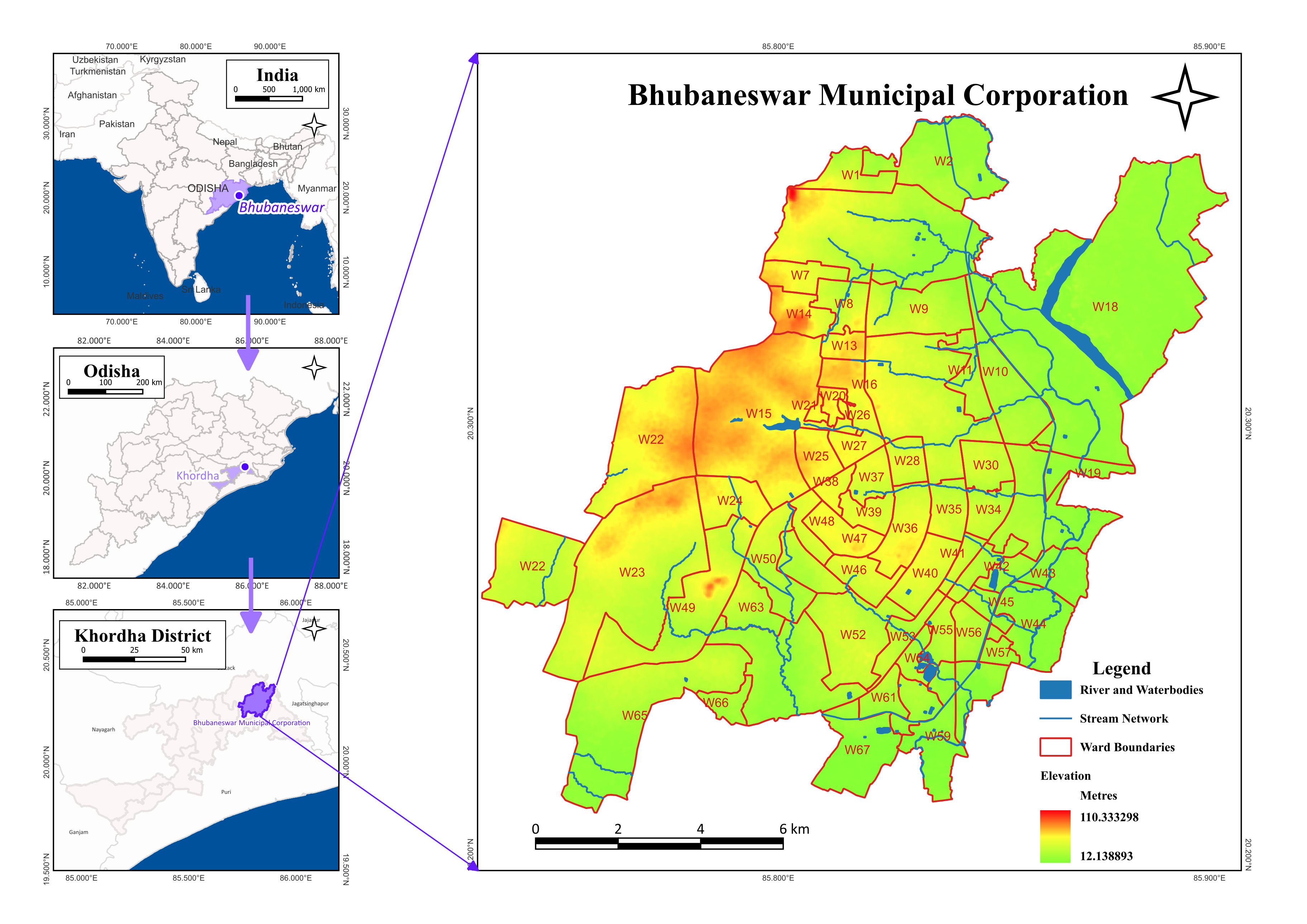
Bhubhaneswar Map
This was prepared for a report on nature-based solutions for flood management published by NIUA in 2025, made using QGIS. This report is the culmination of the “Proliferating Ecosystem Based Adaptation Practices in Indian Cities (EPIC)” project, which focused on designing and implementing nature-based infrastructure for managing flood risk in Bhubaneswar, India. Bhubaneswar, the capital city of the state of Odisha, lies on the coast of the Bay of Bengal, and is prone to severe cyclones. This project focused on restoring and creating a plan for maintaining natural drains and waterbodies. These had been polluted and concretized from pressures of rapid urbanization, but used to be natural flood-resistant infrastructures that worked with the topography of the city.
The map, visible on page 12 of the document, shows the elevation, water bodies, and ward boundaries of Bhubhaeswar. It shows the elevation dropping nearly 100 m from the West to East of the city, and the drains that follow that elevation, carrying water out of the city.
Thank you for visiting my webpage. If you are interested in collaborating, please feel free to reach out!